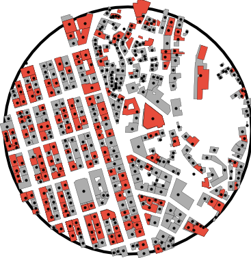
Counting buildings in downtown Lisbon
Used data from OpenStreetMap and city government to visualize construction permits issued for Lisbon's historical center. Also made a pretty GIF.
#lisbon#urbanplanning#data
Small data-analysis rabbit holes — a question I got curious about, the dataset I dug into, and what I found.
Used data from OpenStreetMap and city government to visualize construction permits issued for Lisbon's historical center. Also made a pretty GIF.
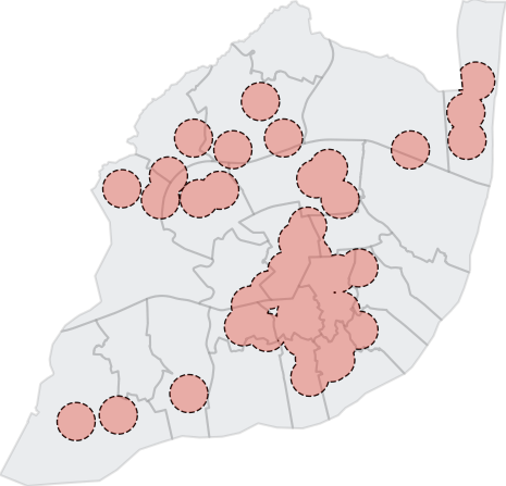
Combined data from Zomato's API and geometric manipulations to estimate the proportion of Lisbon's surface area and population that lies within a 5-min walk of a Padaria Portuguesa.
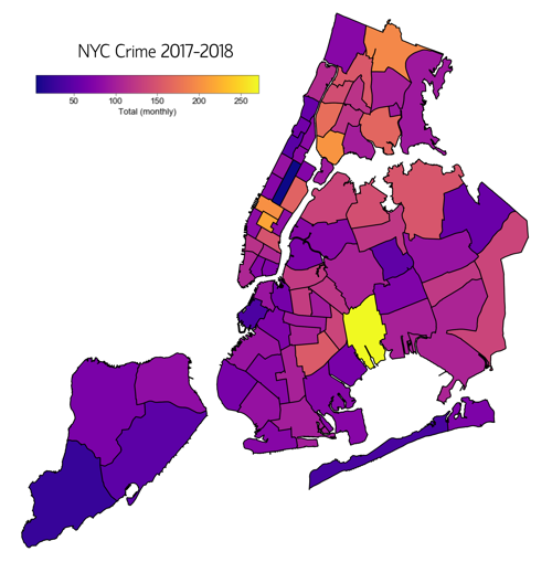
Using NYPD complaint data, I forecast crime rates with ARIMA models and used unsupervised clustering to find hotspots — pointing to where and when to patrol.